
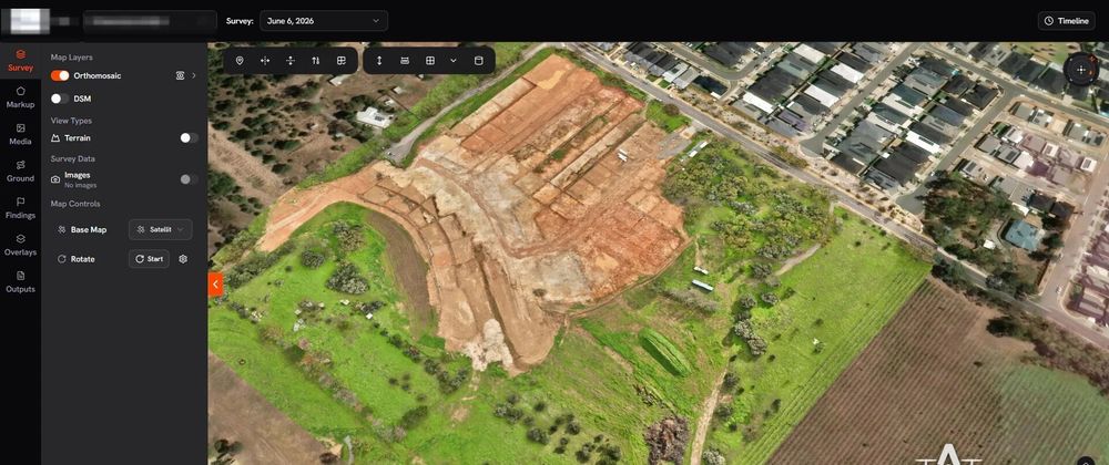

In the rapidly evolving agricultural landscape, smart farming tools have become indispensable for enhancing productivity and minimizing resource waste. Among the technological breakthroughs making significant strides in this sector are agricultural drone mapping surveys. As the United States faces increasing pressures from climate change, population growth, and a demand for sustainable farming practices, it's no wonder that farmers and agricultural businesses are turning to drone mapping surveys to revolutionize their practices.
Understanding Drone Mapping Surveys
A drone mapping survey employs unmanned aerial vehicles (UAVs) equipped with advanced imaging technology to create high-resolution aerial imagery and gather crucial data related to agricultural land. These surveys provide detailed insights into crop health, soil conditions, and potential problem areas across vast expanses of farmland.
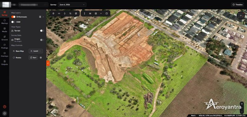
While many might assume that this technology is a novelty, it has proven to be a game changer, offering precision that traditional farming methods simply cannot match. By employing drone mapping surveys, farmers can make informed decisions based on real-time data rather than relying solely on guesswork or infrequent soil examinations.
Benefits of Drone Mapping Surveys in Agriculture
Precision Agriculture: The foremost benefit of drone mapping surveys is precision agriculture. Detailed aerial imagery allows farmers to identify crop variability across their fields. This enables them to apply the right amount of water, fertilizer, and pesticides exactly where needed, leading to enhanced yields and reduced waste.
Time Efficiency: Conducting traditional surveys can take weeks, demanding extensive labor and resources. In contrast, drone mapping surveys can cover large areas in a fraction of that time. Farmers can quickly assess the health of their crops and make timelier decisions.
Cost-Effectiveness: Although upfront investment is required for the technology, the long-term savings are compelling. Accurate data from drone mapping surveys can reduce costs associated with over-application of inputs, which can lead to environmental damage and financial waste.
Enhanced Crop Monitoring: Continuous monitoring capabilities offered by UAVs provide farmers with a comprehensive view of their crops' health throughout the growing season. This early detection of issues such as pests, diseases, or nutrient deficiencies can save crops and foster better harvests.
Data-Driven Decision Making: The insights derived from drone mapping surveys empower farmers to make strategic decisions based on hard data. Whether it involves optimizing planting patterns or determining the best times for irrigation, data-driven decision-making ensures better resource management.
Why Aeroyantra Technologies Private Limited?
Aeroyantra Technologies is dedicated to integrating advanced technologies into agriculture. While we do not manufacture drones, our expertise lies in providing innovative solutions that leverage drone mapping surveys, bridging the gap between traditional farming practices and modern agricultural techniques. Our commitment to enhancing agricultural productivity through technology has positioned us as a leader in the smart farming movement.
The Future of Drone Mapping Surveys in USA Agriculture
The agricultural landscape in the USA is at a crossroads. As farmers seek ways to increase efficiency and sustainability, the adoption of drone mapping surveys will likely accelerate. Agriculture is increasingly moving towards data-centric strategies. As remote sensing technology continues to advance, we can expect more refined tools and analytics software to complement drone surveys.
With ongoing improvements and innovations, drone mapping surveys will not only provide farmers with a more profound understanding of their fields but also help them adapt to changing environmental conditions. The future looks promising for smart farming, and embracing technology like drone mapping is key to ensuring the sustainability and productivity of agriculture in the United States.
FAQs
Q1: What is a drone mapping survey?
A drone mapping survey involves the use of UAVs equipped with cameras and sensors to capture high-resolution images of agricultural fields. This technology helps assess crop health, monitor growth, and manage resources efficiently.
Q2: How does drone mapping improve agricultural yields?
By providing precise data on crop conditions and soil health, drone mapping enables farmers to make data-driven decisions. This leads to optimized resource applications (like water and fertilizers), which ultimately enhances yields.
Q3: Is a drone mapping survey expensive?
While the initial investment may be higher compared to traditional methods, the long-term savings in resource management and increased yields often outweigh these costs. Many farmers find drone mapping surveys to be a cost-effective solution over time.
Q4: Can drone mapping surveys be used for all crops?
Yes, drone mapping surveys can be effectively employed across various types of crops, adapting to different farming methods such as row crop farming, orchards, and vineyards.
Q5: Are there any regulations associated with using drones in agriculture?
Yes, drone operations in the USA are regulated by the Federal Aviation Administration (FAA). Farmers interested in using drone mapping surveys should comply with FAA regulations and may need to obtain licenses for commercial drone use.
In conclusion, the momentum behind drone mapping surveys in agriculture is undeniable. With its ability to enhance productivity, reduce resource waste, and support sustainable practices, this technology is changing the agricultural game in the USA. Aeroyantra Technologies stands ready to assist farmers seeking to adopt these innovative solutions, guiding the future of farming towards greater efficiency and sustainability. By embracing smart farming techniques, the agricultural industry can confidently move forward to meet the demands of a growing population while caring for the environment.






Top comments (0)